The fascinating history of the Blavet
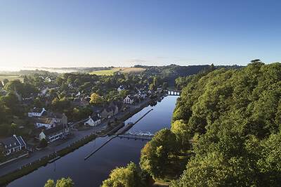
Geography of the Blavet River
The Blavet — ar Blavezh in Breton, meaning “gushing water” or “running water”—is a river full of surprises.
It springs to life at 280 meters above sea level in the heart of the Argoat in Côtes d’Armor. From there, it rushes down the Mené Massif before taking a well-earned pause at Lake Guerlédan, Brittany’s largest man-made lake.
Eventually, it joins the Scorff and flows into the sea at Lorient, opposite Port-Louis, the fortress historically known as the Blavet. Over its 58-kilometre course, the river invites both contemplation and sailing, passing through 28 locks before reaching Hennebont, where the tide’s influence rocks the river.
Several tributaries feed the Blavet along its journey: the Sarre and Brandifout on the right bank at Melrand, and the Tarun and Evel on the left bank at Baud.
The Blavet: Shaped by Man
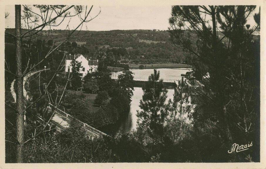
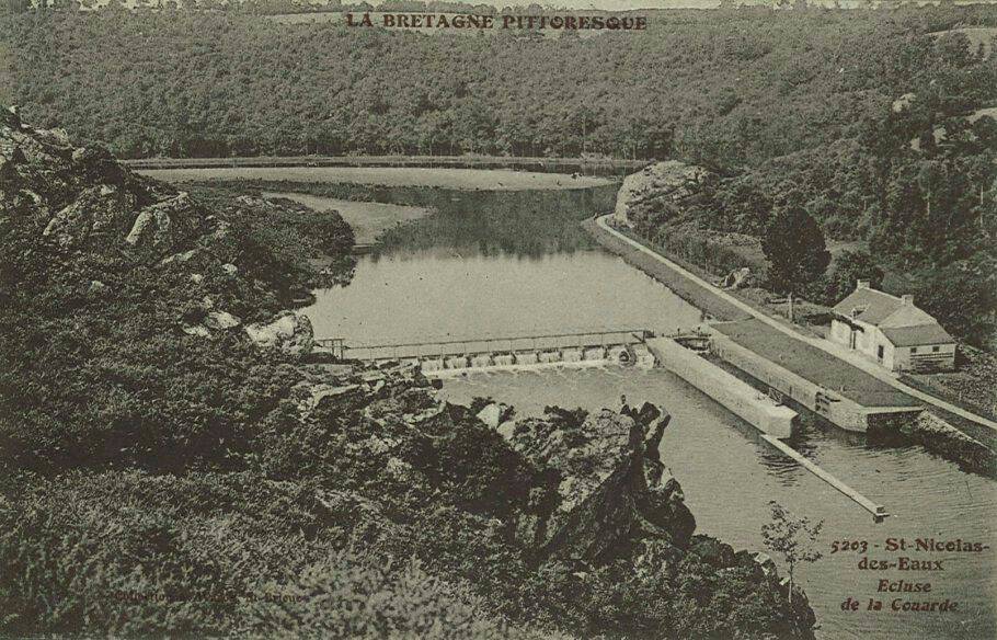
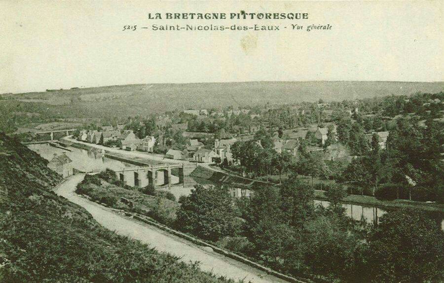
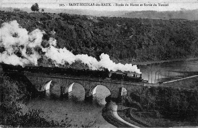
Postcards from www.lecartonvoyageur.fr
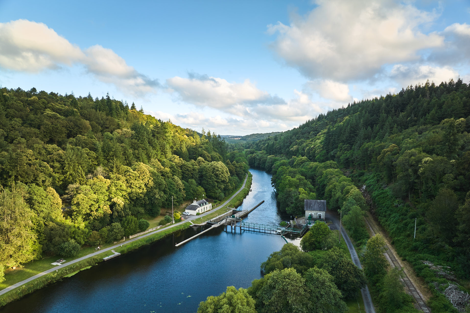
The course of the Blavet, largely artificial, has been carefully shaped over the last two centuries to meet human needs—providing electricity, supporting navigation, supplying drinking water, and regulating flow.
In 1785, three citizens led by Citizen Thistle undertook an ambitious journey from Pontivy to Hennebont to explore the river’s navigability. The journey took four days, partly by boat and partly on foot, carrying their vessel over fisheries and the many mill dykes along the Blavet.
During his wars with England, Napoleon I sought to link Pontivy to the Bay of Biscay via the naval port at Lorient. In 1802, major canalization works were authorized: 27 locks with lock houses and 360 bridges and culverts were constructed to overcome a 54-metre elevation difference. At Saint-Nicolas-des-Eaux, a tunnel was drilled through a hill to allow the railway line to pass.
The work was completed in 1825 under Charles X, and on November 4th, the Blavet Canal was inaugurated with great celebration. The boat Marie-Thérèse arrived in Pontivy to the applause of the local population, marking a new era for this strategic river.
A few years later, a major new project transformed the valley: the construction of a railway line to link Pontivy more directly to the coast and speed up trade. Approved by imperial decree under Napoleon III and inaugurated in 1864, the 53-kilometre line from Auray to Pontivy was a massive undertaking. Seven bridges had to cross the Blavet, and two long tunnels were dug, with hundreds of workers—lumberjacks, tree pruners, earthworkers, stone cutters, and track layers—contributing to the construction of these impressive structures.
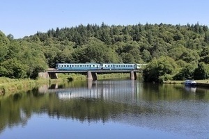
Today, the “Napoleon Express” tourist train runs along the Pontivy–Lambel-Camors section, stopping at Saint-Nicolas-des-Eaux, Saint-Rivalain, and Quistinic. Returning in summer 2021, it offers passengers a chance to enjoy breathtaking landscapes along the Blavet Valley.